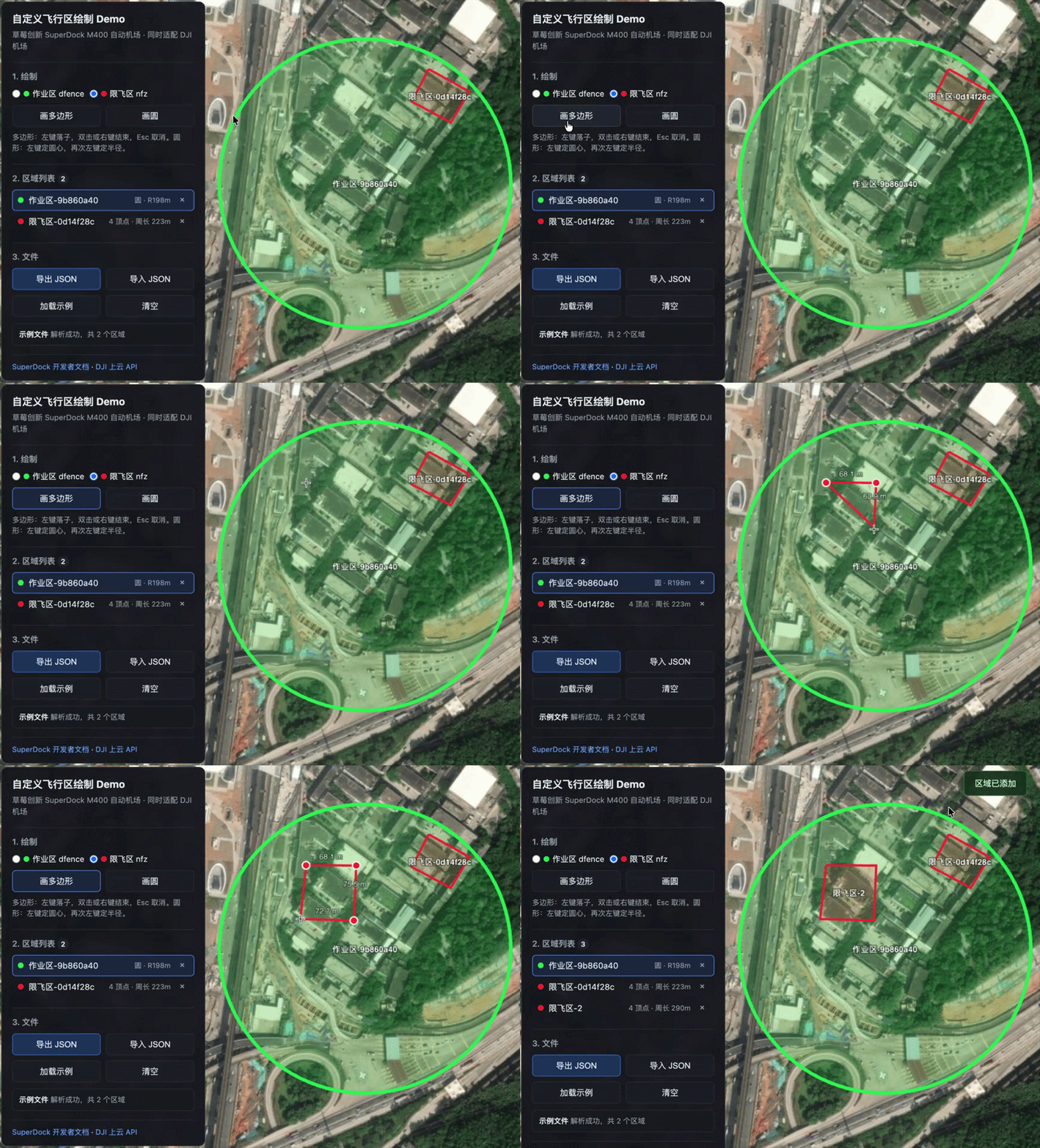
In autonomous drone operations, planning a route is only the first step.
Many projects have more specific requirements: drones must stay inside a campus, keep away from office buildings, communication towers, and hazardous facilities, and never enter temporary control zones.
Safety is critical in these scenarios. In the past, such restrictions often depended on manual route planning and repeated onsite confirmation.
For example, when a tall building is nearby, operators may have to set an unnecessarily high return-to-home altitude. This wastes flight time and may create airspace compliance concerns when the altitude exceeds 120 meters.
In another case, a zone with signal interference may force operators to proceed with extreme caution every time the drone approaches it, to avoid losing video transmission or positioning.
SuperDock M400 now adds Custom Flight Areas. Teams can define drone activity boundaries on the map in advance, making missions safer and platform management more dependable.
What is a Custom Flight Area?
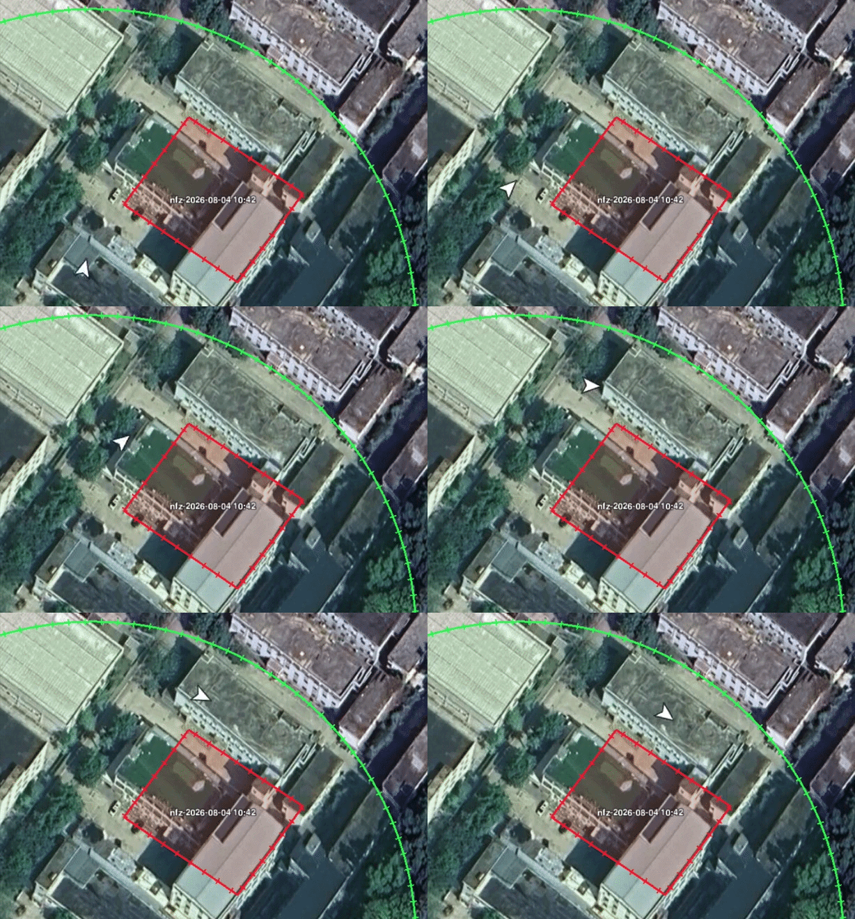
Think of it as drawing an electronic fence for the drone. It includes two types of areas:
Custom Operation Area
Where flight is allowedFor campus security, the entire campus can be defined as an operation area. Whether executing a mission or rerouting during return-to-home, the drone will not cross the perimeter.
Custom Restricted Area
Where entry is prohibitedTall buildings, communication towers, hazardous facilities, confidential areas, and temporary control zones can all be configured as restricted areas.
- Operation areas define where the drone may fly.
- Restricted areas define where the drone must not enter.
The two can be layered together: use one large operation area for the overall boundary, then cut out restricted areas inside it to avoid obstacles and sensitive locations.
What happens at a boundary?
Return-to-home or point flight meets a restricted area
The drone automatically detours and continues the mission.
A route mission approaches the boundary
The mission automatically stops and the drone immediately returns home.
Manual control approaches the boundary
The drone automatically hovers and cannot be pushed across the boundary.
Where can it be used?
- Campus security and routine patrols
Set industrial parks, schools, communities, or logistics campuses as operation areas, while marking office buildings and crowded spaces as restricted areas.
- Energy and infrastructure inspection
Define the overall inspection scope for power, solar, wind, and communication projects while avoiding high-risk equipment, construction areas, and unsuitable approach zones.
- Construction sites and mining operations
Adjust areas as work progresses, excluding cranes, blasting zones, and temporary storage yards from drone missions.
- Temporary events and emergency missions
Redraw safety areas and synchronize them to devices as onsite conditions change during events, temporary construction, or incident response.
Configure it in three steps
- 1
Draw areas on the map
Create operation and restricted areas based on onsite conditions, using common circle and polygon shapes.
- 2
Synchronize with the dock
Synchronize while the dock is idle, or include the relevant parameters when starting one-click takeoff or a route mission so the dock receives the latest areas before takeoff.
- 3
Review synchronization and flight status
The platform shows whether synchronization succeeded and can provide distance-to-boundary prompts during flight.
We also open-sourced the drawing module
To help more developers integrate quickly, we released a lightweight Custom Flight Area drawing demo with support for:
- Operation and restricted area drawing
- Circle and polygon areas
- Validation checks
- Existing file import and standard file export
- Embedding as a frontend module in an existing platform
Exported files can be used directly with SuperDock M400 or DJI docks. The project link can also be given to an AI coding assistant as a reference for integration into an existing platform.